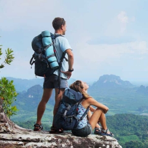
The most important attraction, for which many tourists come to Vorokhta, is of course Hoverla. It is about climbing it and will be discussed.
Because before the lift, not one web page was studied and now I can first tell me how to get on it and answer all the questions that have arisen, I will be happy to tell you what to see what.
I had a goal - to rise to Hoverla. From this pushing out all the information about where to settle the closer, led in Tryokhta. No, of course, this is not the only place where you can stay, but it is very popular, and also very beautiful, as it turned out. Come here, you will not regret.
Everything turned out to be quite simple. And sitting at home in front of the computer screen, calling the friends who were there, and they do not really remember and do not tell anything, their hands are lowered.
What to do to climb Hoverla?
Where to settle?
What time to start the route?
What to take with you?
What is the base "Zaroshak"?
Why do you need to take a taxi?
How long does the rise take?
Will we have time in one day?
All these questions were open and the reviews of other people did not give me accurate answers, on the contrary, only more confused and gave full chaos, when they write in one place, which rose to Hoverla for 3 hours, and others that spent on it all day, then Who to believe? It sometimes it seemed that the idea could break, that, only the night in the tent, we could conquer the mountain, and in the place in more detail it will be prompted by the owners of removable housing, and we will see.
So, Hoverla. This is the highest mountain of the Ukrainian Carpathians, her height is 2061 m. It is for statistics and general information. To understand what kind of height will overcome.
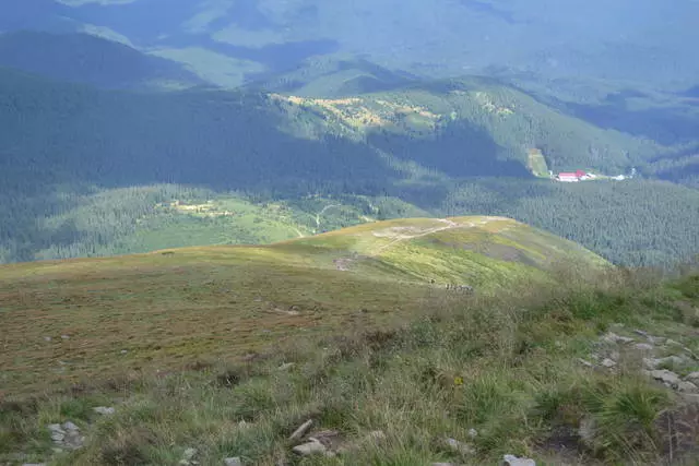
The photo is done on top. Little red house at the bottom - the beginning of the way
In order. To climb the goverla, the rod is suitable in the best possible way. Yes, there are settlements and closer, all sorts of cottage houses, practically at the beginning of the path, but the cost of living in them is higher and getting to them will not be easy, especially not having personal vehicles.
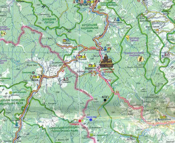
I will start with the fact that the lifts on the mountain have a lot from different sides. I'll tell you about the path from Worokhta. In this case, Goverla is located on the road, which leads to the top. It is worth taking care of a taxi, which will bring a tourist base called "Zaroshak". On its territory there is a checkpoint. Taxi can not be taken only if you make a trip with tents, and in the evening there is no return to the hotel or removed housing. In all other cases, I advise 22 km. overcome on transport. This year the car cost 200 UAH. But prices are individual, how to agree with the taxi driver. Ride from Worokhta about an hour of time in a straight dirt road, places with bad asphalt.
On the day to which the climb is planned, it is worth providing for all the weather. There should be no rain, otherwise, it will have to postpone climbing, it is dangerous due to thunderstorms in the mountains. If you are lucky, you can see the morning fog in the mountains. Very early to get up there is no need. If a taxi driver is lucky, you can go from the house at 8-10 in the morning.
Driving to the checkpoint on personal transport, taxi or foot, everyone is registered. Paid 20 UAH. At the same time, at least one person should have a document that is presented for registration. As it seemed to me that it was all very conditionally and formally, but the check with payment is issued, and we will believe that everything goes to the development of forestry.
The scheme is issued with the route,
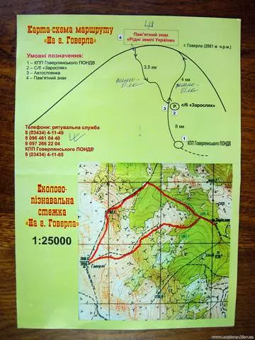
There is also hanging a stand, where the same scheme of only large sizes.
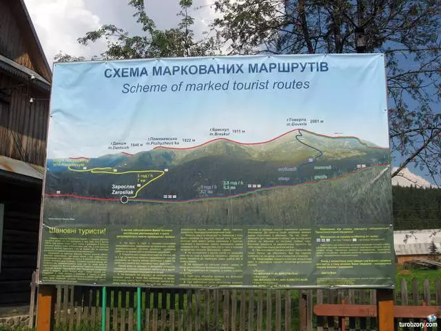
It is good that our taxi driver advised us how it would be better because for unprepared tourists is the perfect option. There are two trails: blue and green, both of them lead to the top. One of them is longer, but more common, the second is shorter and plain. It is easier to climb the long (green) and descend on short (blue).
Green trail of 4 km long. Blue trail - 3.5 km. Total time for lift-descent - 5 hours.
It is worth adding time for all sorts of priges, photos.
Since the mobile communication does not catch in the mountains, then with a taxi driver agree in advance about the time in which to take back. At first it seemed very uncomfortable, but here in any way. Taxi driver immediately said, I will come in 5 hours. We asked him to come after 6 hours. At the top once again they scored, they said that we are going slowly, we take pictures, make the privals and eat raspberry, so it's not worth a hurry. At the very bottom there are also souvenirs sell, Mulled wine, tea, so if you wait for a taxi, and not the opposite, then there will be something to do.
Regarding food. In the reviews, I read that I should not take food on Hoverla, that when the lift is definitely not up to it. It is worth taking care of the water and buy themselves chocolate. Next to the beginning there is a source, so mineral water can be dialing right there. I don't want to eat at all. On the way upstairs, we ate along the apple and that, just because they took with them. On the road, raspberries and blueberries, which chocolates there. But at the top and indeed you want to drink tea with chocolate, eat a sandwich and even small canned food. Reviews that on top Everyone is inspired by champagne and in Euphoria are rejoiced to everyone who rissed did not justify, but once at times they do not have to. You can start the first step, take champagne and be friendly, treating on top of those who want.
All the way can be divided into three parts: first by the forest, then on the stones, and the third in open locality, but for the tired tourists, the most difficult thing is already. Trails begin together and soon disagree. In the forest part, it is a little more difficult to look for marking, but soon the eye gets used and easily oriented in the marks. The farther, the more pronounced like the road becomes. Dressed very warmly (in the mountains, we go), we already cheated in the forest, and by the end of the forest remained in T-shirts. "The second" part of the path we walked under the sun and that was removed, you put on a long sleeve sweatshirt, and on the third "plot there was a mountain wind, we dressed up again all that was, stretched the hoods and were glad about the top.
At the top is full of people, as on the cavity.
A, having descended from the mountain, you can purchase a medal about its conquest, a certificate of climbing or literacy for a long memory.